
A Story To Tell: Seeing Through the Minds of Two Admirals
- Eda Ozyesilpinar -
FIGURES
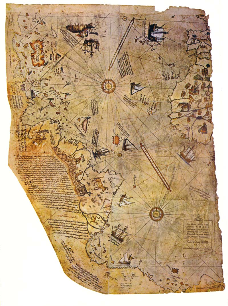
Fig. 1. Piri Reis (Mapmaker). (1513). Map of 1513 [Map]. Retrieved July, 08, 2013, from: http://www.sacred-texts.com/piri/pirireis.jpg
Fig. 3. Piri Reis [Image]. (n.d). Retrieved July, 08, 2013, from: http://blog.denizgirgin.com/wp-content/uploads/2013/06/P11.jpg
Fig. 4. Piri Reis [Image]. (1521). Cover of Kitab-i Bahriye. Originally printed in: Afetinan, A. (1954). The oldest map of America, drawn by Piri Reis. Ankara: Turk Tarih Kurumn Basimevi.
Fig. 5. Piri Reis (Mapmaker). (1528). Map of 1528 [Map]. Retrieved July, 08, 2013, from: http://www.crystalinks.com/pirireisworldmap2.jpg
Fig. 6. Piri Reis (Mapmaker). (1513). Map of 1513 [Map]. Retrieved July, 08, 2013, from: http://www.sacred-texts.com/piri/pirireis.jpg
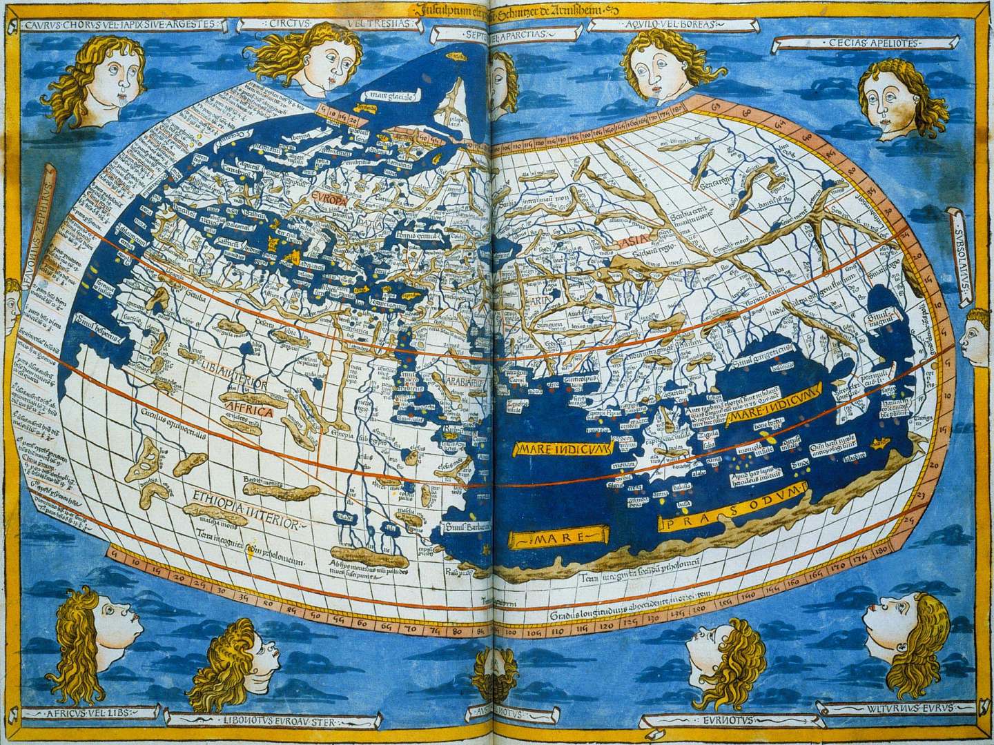
Fig. 7. Ptolemic world map [Map]. (n.d). Retrieved July, 08, 2013, from: http://www.mlahanas.de/Greeks/images/PtolemyMapLarge.jpg
Fig. 8. Pierre d’Ailly (Mapmaker). (1410). A world map in Imago Mundi. Retrieved July, 08, 2013, from: http://www.henry-davis.com/MAPS/LMimages/238A.jpg
Fig. 9. Pierre d’Ailly. (1410). Notes of Columbus in Imago Mundi. Retrieved July, 08, 2013, from: http://www.heritage.nf.ca/exploration/images/mundi.jpg
Fig. 10. Anonymous Genose Chart [Map]. (1488-1493). Retrieved July, 08, 2013, from: http://www.henry-davis.com/MAPS/LMimages/257.jpg
Fig. 12. Timeline mapping the connections between Reis and Columbus with a focus on locations. Three images in this timeline:
-
The connection between Columbus and Piri Reis [Image]. (n.d). Retrieved July, 08, 2013, from: http://www.crystalinks.com/pirireis.html
-
1490 Anonymous Columbus Map [Map]. (1490). Retrieved July, 08, 2013, from: http://www.henry-davis.com/MAPS/LMwebpages/257A.html
-
Voyages of Columbus [Image]. (n.d). Retrieved July, 08, 2013, from: http://www.emersonkent.com/history_notes/christopher_columbus.htm
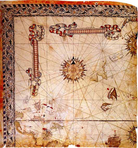
Fig. 13. McIntosh, G. (Figure creator). (2000). Rhumb lines and compass roses of the Piri Reis map. Originally printed in: McIntosh, G. C. (2000). The Piri Reis map of 1513. Athens: University of Georgia Press.
Fig. 15. Distribution of color use on the Reis map [Image]. (n.d.). Retrieved Nov 28, 2013, from: http://www.istapin.com/piri-reis-ve-1513-dunya-haritasi-500-yilin-gizemi-sergisi-2/
Fig. 19. A Story to See: An Infogram [Image]. (n.d.). Retrieved Nov 28, 2013, from: http://www.bastirgelsin.com/p/piri-reis-haritasi-cam-duvar-saati-15365/
Fig. 21. Visual representation of Columbus’s first interaction with the natives of the Americas [Image]. (n.d). Retrieved July, 08, 2013, from: http://static.ddmcdn.com/gif/c-columbus-12.jpg
Fig. 22. Visual representation of Reis working on his map [Image]. (n.d). Retrieved July, 08, 2013, from: http://haberpan.net/haber/13/04/11/3e81/piri-reis-aniliyor.jpg
Fig. 23. Piri Reis Map 500th Anniversary [Video]. (2013). Seeing the Reis map in the eyes of 21st century audience. Retrieve Nov 28, 2013 from: http://vimeo.com/77373888
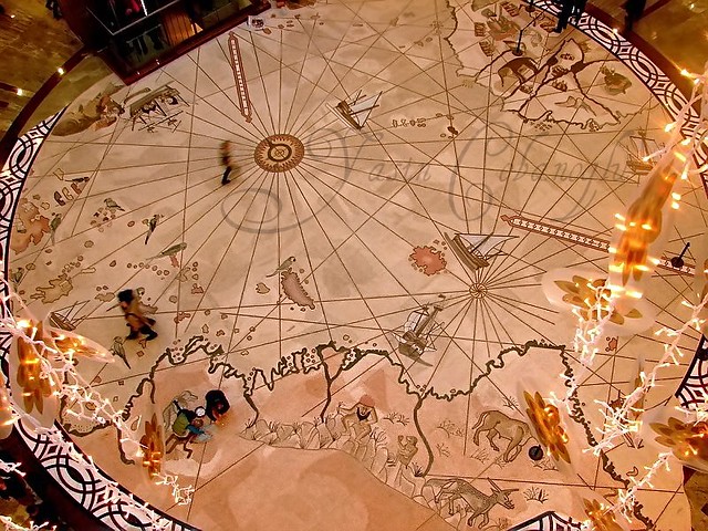
Fig. 24. The Reis Map [Picture]. (n.d). Retrieved July, 08, 2013, from: http://farm3.staticflickr.com/2361/2147660616_57555a4506_z.jpg?zz=1